Tag Archives: Buildings

St Mary’s Chapel wall

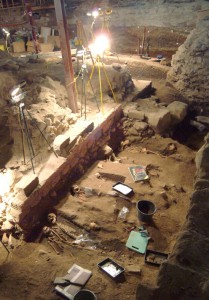
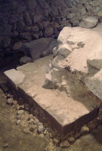
In this post, we continue reviewing the development of the building as shown by the walls uncovered during the archaeology. This one looks at the building of St Mary’s Chapel. As with most of the early work there is insufficient written information to say when the work took place. It is known that from the early 15th century, plans were being made for the expansion of the relatively small main church to create a cathedral-sized building. However, this was hampered by the lie of the land. The existing building was on the top a small hill, with the ground sloping away gradually to the south towards the harbour and to the north towards the Loch. To the west was the Denburn valley and immediately to the east the fairly steep slopes of the Putachie Burn. Some idea of the latter can be seen today in the form of the steps down from the Kirkyard to the top of Correction Wynd.

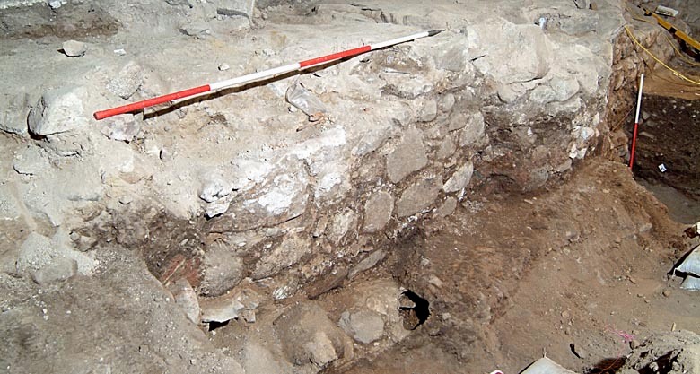
In order to facilitate the expansion to the east a separate building was erected. This was a chantry chapel, now known as St Mary’s Chapel, which would act as an undercroft to allow the expansion of the church building above it at a later date. During the archaeological dig the west wall of the Chapel was uncovered and is shown as it is today in the photograph. The exact date of building the Chapel is not known, but it was probably around the 1440s. At the time it was erected St Mary’s Chapel was a completely separate building in the burial ground, about 10 feet to the east of the existing church building. There were burials in the ground between the two buildings and the west wall of St Mary’s Chapel was actually built on top of some of the burials.

Post 39 St Mary's Chapel wall
West wall of St Mary’s Chapel from the dig area

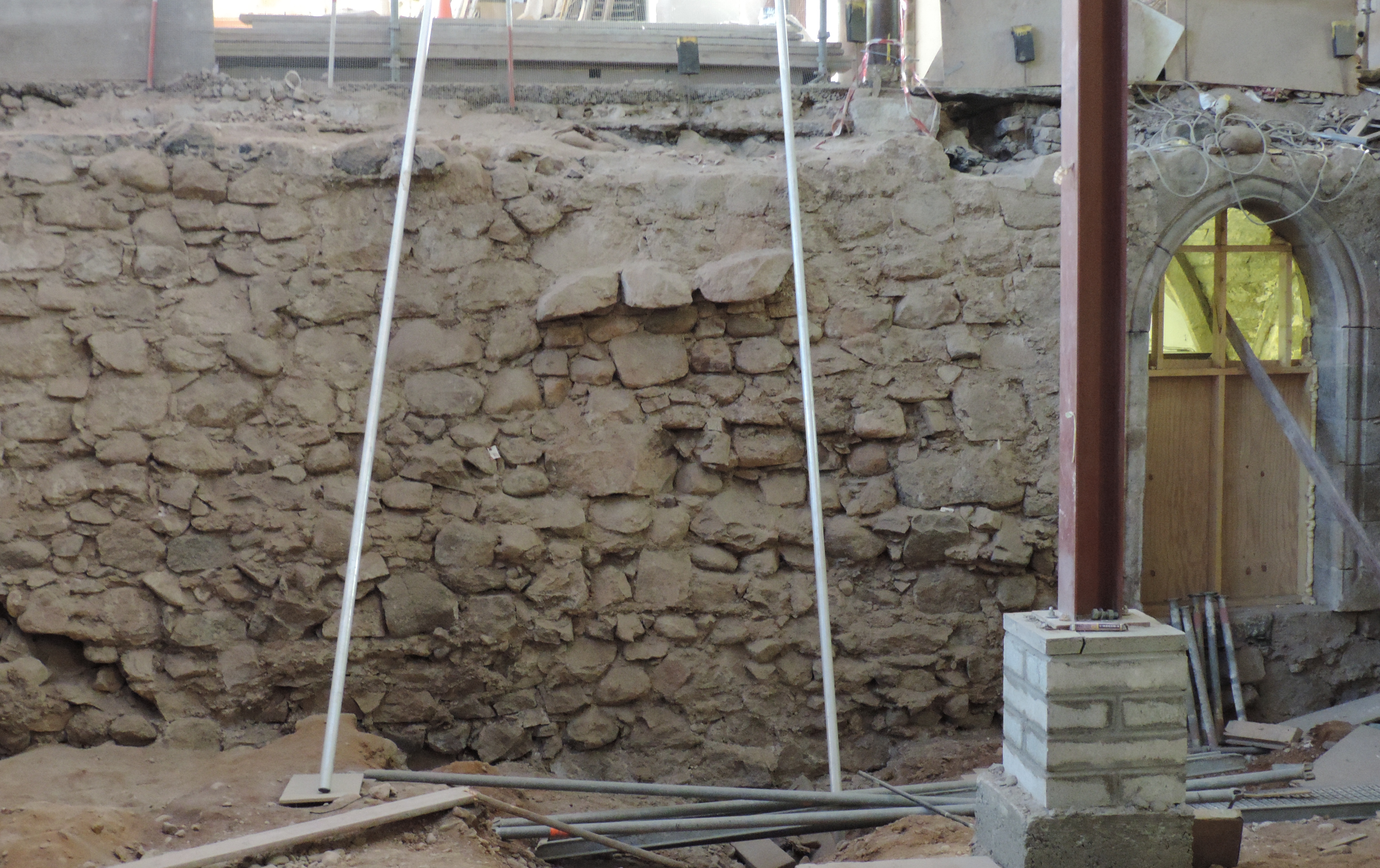
There are two doorways through the wall which would have allowed access to the expanded building above – one can be seen in the photograph to the right, with a light in the Chapel showing through. One doorway lead to a stairway, part of which still remains. The other may have had a stair, but there is also evidence that there was some sort of sloping path or ramp (this will feature in a later blog). The wall itself has various features, the most obvious of which can be seen in the  centre of the photograph, namely the protruding stones. It is assumed that these were built like this to allow the expanded church building to key into the wall. They would have acted as the springer, or lowest voussoir, of the arches supporting the floor of the expanded church later in the century. The top of the wall in the photograph was at the floor level of the former East Kirk. The soil which can be seen is at the ground level of Aberdeen a millennium ago. The vertical steel beam to the right is part of the temporary supports for the gallery above.

12th Century Chancel wall

In October 2014, when we posted about the east end of the 12th century building, we indicated the intention for a series of posts giving further information about the stages of development of the present building. This is the first of this series with the rest appearing intermittently during the course of 2015.

Pillar base ( Central ) in raft IB Aberdeen Art Gallery and Museums Collection
Part of the 12th century north transept wall with pillar base in centre

When the archaeological dig began in 2006 it was not known what, if anything, would remain of previous buildings on the site, since each could have been demolished before erecting the next building. The reality was that a great deal was preserved. Thus, the lower levels of the whole of the chancel of the 12th century building were uncovered. Whilst both the north and south walls (the side walls of the chancel) were intact, the photographs in this blog are of the north wall. The stonework from the north wall was well preserved and can be seen in the first photograph. The wall is about 4 feet thick from inside to outside. However, some of the wall had been removed when the church building was being expanded in the late 1400s. This later building was to have massive pillars to carry much of the weight of the roof. These pillars required to have very stable foundations to avoid any danger of movement, so the builders made use of the existing walls. They did this by removing some stones to create circular ‘gaps’ into which large stones were placed to form the pillar bases. This ensured that there would be no east-west movement. The first photograph shows the north wall, viewed from inside the chancel, with a 15th century pillar base built into the 12th century wall. The pillar base is distinguishable by its curved shape (in the centre under the measuring pole). To its right is some ‘flat’ wall from the 12th century and then another pillar base at the right hand end of the wall.

One of the smaller stones
Post 30 (c) Week 26 One of the foundation stones
One of the larger stones in situ
Post 30 (d) Week 30 Removal of large stone
Mechanical means were needed to remove larger stones

As part of the excavation it was necessary to remove both the original walls and the pillar bases. The size of some of the stones used to form the pillar bases was impressive. The second photograph shows Stewart Buchanan, deputy leader of the dig, carrying a smaller stone. The third photograph shows Stewart with one of the larger stones and deciding it is a bit too big for him to carry! Indeed to remove these it was necessary to erect a block and tackle to lift them into a mechanical tipper to get them out of the building, as shown in the final photograph. That the builders of more than 500 years ago could handle these stones and accurately place them into position deserves every credit.

To the east end the walls had been rebuilt to bond with the new east end as described in the 20 October blog. At the west end, the wall emerges from the walls of Drum’s Aisle which was the transept of that 12th century building. Drum’s Aisle is still used today and is part of the Kirk of St Nicholas Uniting and also houses St John’s Chapel, often known as the ‘Oil Chapel’. It is obvious, but it is worth noting that, until the late 1400s, the church building was far smaller than the present day building. Outside the walls (the opposite side to the photograph) was the graveyard which was taken inside the building when it was expanded in the late 15th century. Once the Mither Kirk Project redevelopment is complete it will be possible to see the western ends of both the north and south walls as they have been kept and will become a feature at either side of the early apse (see blog on 4 May 2014).

The photographs, which are copyright Aberdeen Art Gallery & Museums Collections, are used with permission.

An early church building

Being certain of the age of an old building is almost impossible. Frequently there is very little written evidence and what there is may be inconclusive. Dating therefore comes down to using circumstantial evidence, archaeological findings and experience. In an earlier post, the apse of what was probably the first building on the site of the present Kirk of St Nicholas was shown.

In this post we move forward several decades, perhaps even a couple of hundred years – we just do not know. Part of the walls of the present day Drum’s Aisle, particularly around the ‘Oil Chapel’ date, probably date back to around 1150s. Drum’s Aisle was the transept of a cruciform church, but it was not necessarily all built at the same time. During the archaeological dig in the former East Kirk of St Nicholas, the lower levels of the whole of the choir, the east end that building, were found. The choir would have housed the altar and so, if the erection had been in stages, this would have been built first. The walls uncovered show that the width of the choir as the transept were approximately the same. The choir was about 60 feet long measured from the transept – that is only about half the length of the present building. From this it might be assumed that the nave would also have been of a similar width. Parts of it could still remain under the floor of the West Kirk.

Post 22 (a) View 12 century east end looking north

The walls of the choir were quite substantial. However two different east ends to the building were found. It seems unlikely that this was as a result of making the building larger because the gap between the east walls was only a little over a foot. This poses the question ‘why?’ The stonework in the adjacent side walls probably answers that, since it indicated that the original east end had slipped down the slope of the Putachie Burn and had to be replaced along with a partial rebuild of the side walls. This may have happened as soon as 50 years after it was originally built. The soils exposed during the excavation indicate that the ground was marshy, so could have been quite unstable. The ‘new’ east end was reinforced with buttresses and made of beautifully worked sandstone. The two photographs show a general view of the east end as it was being uncovered (looking in a northerly direction) and the second one is a close-up of one of the north-east corner. The quality of the stonemasonry is obvious.Post 22 (b) Close up of NE buttress of rebuilt east wall

Aspects of the side walls of the choir will feature in a future post.


(The photographs are copyright Aberdeen Art Gallery & Museums Collections and are used with permission).